|
|

|
|
Collier's Mill GHM 060-39
Collier Rd at Redland Rd, Atlanta
(12/22/04) [33°48.610N, 84°24.130W] |
|
|
|
Confederate Battery Position GHM 060-196
Cul de sac at end of River Chase Point, Sandy Springs (8/17/2004) [33°55'22sN, 84°25'41sW]
First marker picture taken for this project. |
|
|
|
Federal Crossings GHM 060-53
Howell Mill Rd at Peachtree Creek bridge, Atlanta
(12/22/04) [33°49.425N, 84°24.960W] |
|
|
|
Federal Right Wing GHM 060-25B
West Paces Ferry Rd at Mt Paran Rd
(1/27/05) [33°51.261N, 84°26.299W]
|
|
|
|
|
|
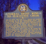
Federal Right Wing to Peachtree Creek GHM 060-26A
West Paces Ferry Rd at Paces Place, just west of I-75
(1/27/05) [33°50.968N, 84°25.972W] |
|
|
|
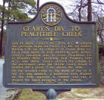
Geary's Div. to Peachtree Creek GHM 060-55
Peachtree Battle Ave at Arden Rd, Atlanta
(1/28/05) [33°49.436N, 84°24.591W] |
|
|
|
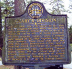
Geary's Division GHM 060-41
Collier Rd at Walthall Dr, Atlanta
(12/22/04) [33°48.683N, 84°24.221W] |
|
|
|
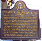
Geary's Refused Line GHM 060-43
Collier Rd and Northside Dr
(12/22/04) [33°48.626N, 84°24.474W] |
|
|
|
|
|
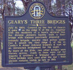
Geary's Three Bridges GHM 060-56
Northside Dr and Wesley Dr, Atlanta
(12/22/04) [33°49.147N, 84°24.462W] |
|
|
|
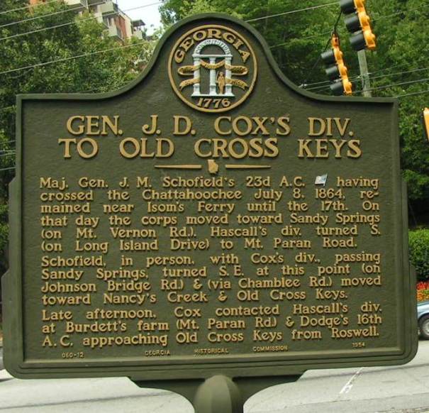
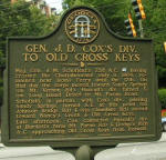
Gen. J. D. Cox's Div. To Old Cross Keys GHM 060-12
Johnson Ferry Rd at Mount Vernon Highway, Sandy Springs
(8/18/2004) [33°55.459N, 84°22.567W] |
|
|