|
|
|
|
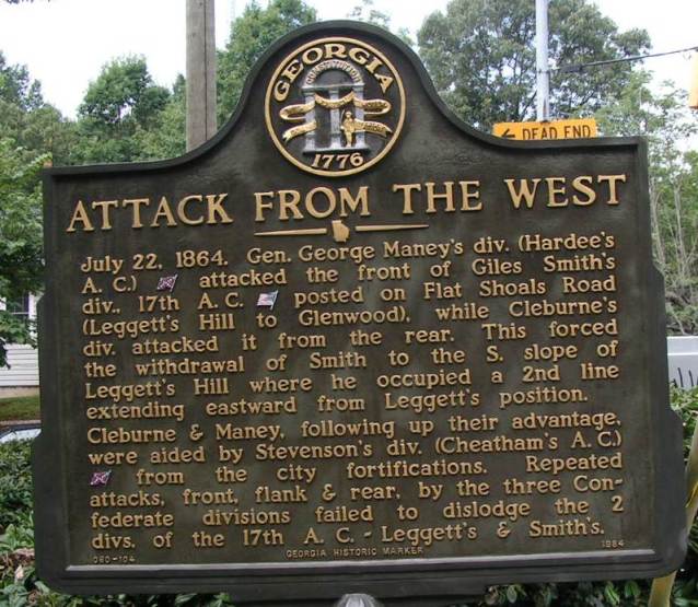
Attack from the West GHM 060-104 Memorial Drive and Stovall Street, Atlanta
(8/11/05) [33°44’48sN, 84°21’15sW] |
|

|
|
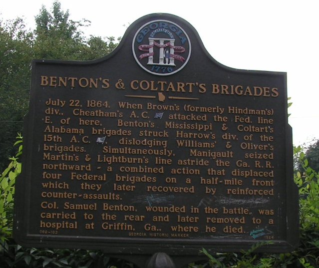
Benton's & Coltart's Brigades GHM 060-103 Boulevard Drive at Walthall St, Atlanta
(8/11/05) [33°45’13sN, 84°21’06sW] |
|
|
|
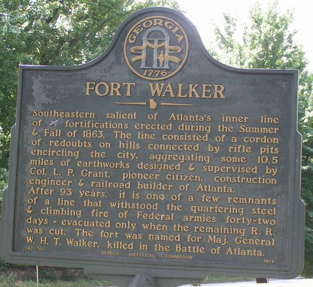
Fort Walker GHM 060-108 Grant Park, Boulevard and Atlanta Ave, Atlanta
(8/11/05) [33°43’49sN, 84°22’07sW] |
|
|
|
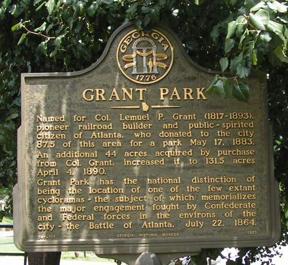
Grant Park GHM 060-107 Cherokee Ave and Georgia Ave at park entrance, Atlanta
(8/11/05) [33°44’03sN, 84°22’25sW] |
|
|
|

|
|
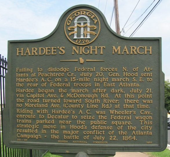
Hardee's Night March GHM 060-105 McDonough Rd just west of Moreland Ave, Atlanta
(8/11/05) [33°42’16sN, 84°21’03sW] |
|
|
|
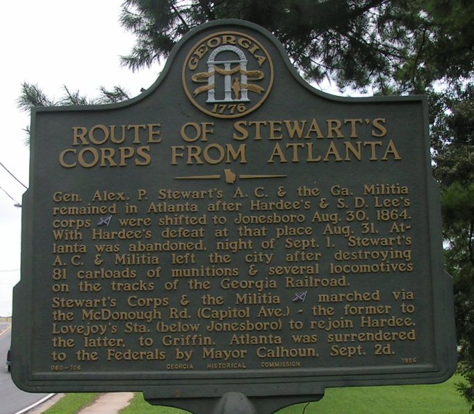
Route of Stewart's Corps from Atlanta GHM 060-106 1075 McDonough Rd 2 blocks west of Moreland Ave, Atlanta
(8/11/05) [33°42’16sN, 84°21’10sW] |
|
|
|
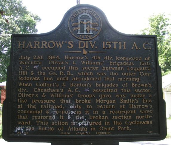
Harrow's Div. 15th A.C. GHM 060-102 1116 Boulevard Drive, Atlanta
(8/11/05) [33°45’13sN, 84°21’02sW] |
|

|
|
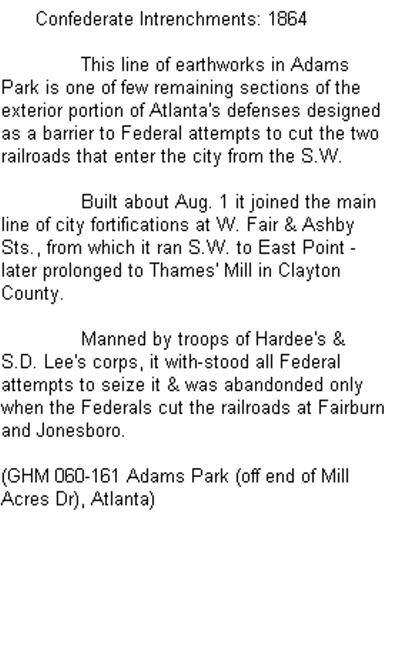
Confederate Intrenchments: 1864 GHM 060-161
Adams Park (off end of Mill Acres Dr), Atlanta
(5/11/2005) [33°42’42sN, 84°28’00sW] [could not find]
Click here to read text. |
|
|
|
|
|
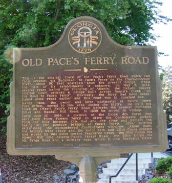
Old Pace's Ferry Road GHM 060-127
Lovett School traffic circle
(04/28/06) [33.85968N, 84.45267W] |
|
|
|
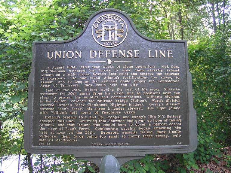
Union Defense Line GHM 060-128
Lovett School on road east of traffic circle
(05/26/06) [33.85844N, 84.45042W] |
|

|
|
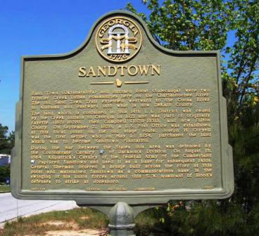
Sandtown GHM 060-129
Fulton County Industrial Blvd at Boat Rock Rd
(04/28/06) [33.72535N, 84.58311W] |
|

|
|
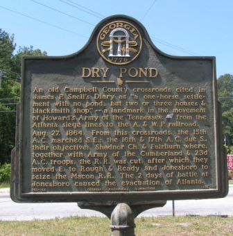
Dry Pond GHM 060-166
Campbellton Rd at Boat Rock Rd
(04/28/06) [33.70872N, 84.55875W] |
|
|


