|
|
|
|
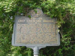
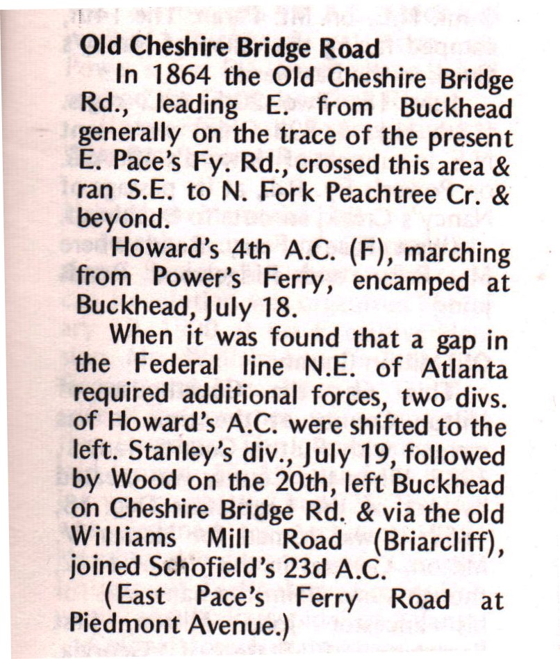
Old Cheshire Bridge Road GHM 060-20
Piedmont Ave at East Pace's Fy Rd, Atlanta
(04/21/06) [33.83850N, 84.36854W]
Click here to read the text.
|
|
|
|
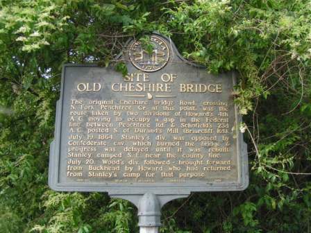
Site of Old Cheshire Bridge GHM 060-21
Buford Hwy just east of Lenox Rd at Shady Valley Dr, Atlanta (04/21/06) [33.82555N, 84.35173W] |
|
|
|
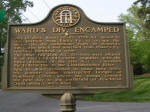
Ward's Div. Encamped GHM 060-28
Andrews Dr and Habersham Way, Atlanta
(04/21/06) [33.83522N, 84.38872W] |
|
|
|
|
|
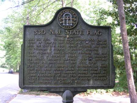
33d N.J. State Flag GHM 060-58
At 1911 Walthall Drive, Atlanta
(04/18/06) [33.80671N, 84.40247W] |
|
|
|
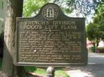
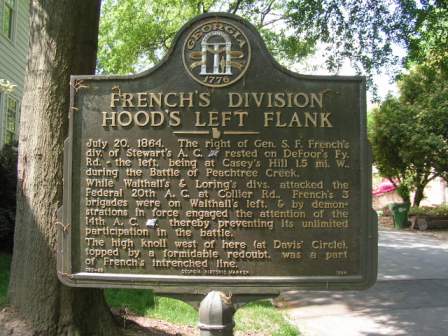
French's Division Hood's Left Flank GHM 060-68
Davis Circle just off DeFoor Avenue, Atlanta
(04/18/06) [33.80365N, 84.42155W] |
|
|
|
|
|
|
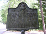
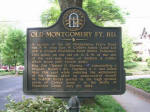
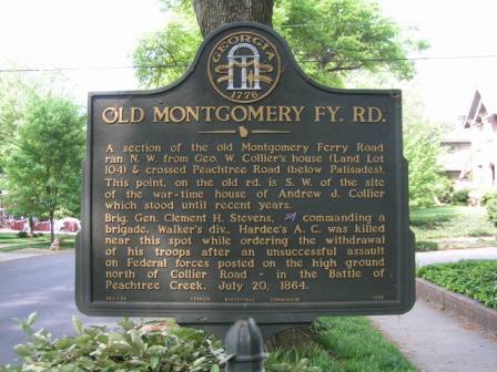
Old Montgomery Fy. Rd. GHM 060-84
28th St and Wycliff Rd, Atlanta
(04/18/06) [33.80532N, 84.39581W] |
|

|
|
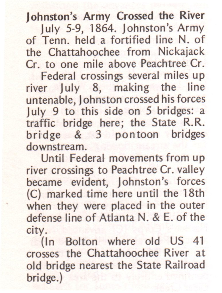
Johnston's Army Crossed the River GHM 060-85
Old US 41 and Marietta Blvd, Bolton
(04/18/06) [33.824274N, 84.457765W] (Marker missing)
Click here to read the text. |
|

|
|
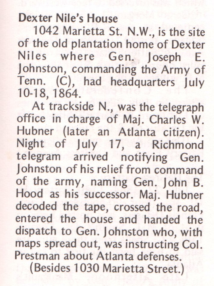
Dexter Nile's House GHM 060-89
1030 Marietta Street, Atlanta
(04/21/06) [33.77902N, 84.410554W] [new development has been built on this location]
Click here to read the text.
|
|
|
|
|
|
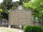
Davis' Hill GHM 060-137
Bankhead Highway (Hollowell Pkwy)at Chappell Rd, Atlanta
(04/18/06) [33.77175N, 84.43362W] |
|
|
|
|
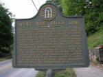
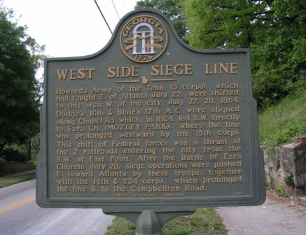
West Side Siege Line GHM 060-140
Chappell Rd just south of Simpson Rd, Atlanta
(04/21/06) [33.76300N, 84.43327W] |
|
|


