
North Carolina Markers
Page 4
 |
 |
|
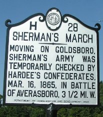
Sherman's March H-28
US 301 S. of Dunn at Long
Branch Rd  . .
(9/3/05) [35°16’37sN, 78°37’43sW] |
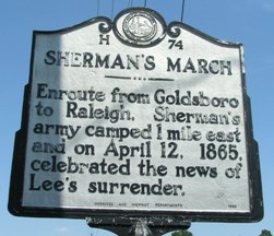
Sherman's March H-74 US 301/NC 96 (3rd St) at Brogden Rd., Smithfield (9/3/05) [35°30’00sN, 78°21’03sW] |
 |
 |
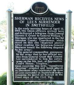
| Sherman Receives News of Lee's Surrender Market and 2nd St. at the Court House, Smithfield (9/3/05) [35°30’42sN, 78°20’50sW] |
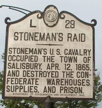
Stoneman's Raid L-29 Main St. (US 70) between Liberty and Kerr, Salisbury (8/27/05) [35°40’11sN, 80°28’01sW] |
 |
 |
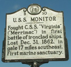
| U.S.S. Monitor B-50
NC 12 N. of Buxton (8/31/05) [35°15’57sN, 75°31’14sW] |
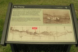
The Fanny NC 12 S. of Salvo (9/3/05) [35°32’01sN, 75°28’32sW] |
 |
 |
|
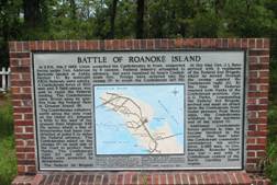
Battle of Roanoke Island BB-4 NC 345 S. of US 64/264 in Manteo (8/30/05) [35°53’20sN, 75°39’37sW] |
Confederate Forts B-38
Fort Hatters and Fort Clark, 2 miles S.W. fell to Union troops on Aug.29, 1861, after two days of heavy naval bombardment. Marker blown away by hurricane. NC 12 at Hatteras ferry landing (8/30/05) [35°12’27sN, 75°42’08sW] |