|
|
|
|
14th A.C. Troops At The Evans Farm GHM 031-29
Old Fayetteville Rd (Evans Rd.) at Church St, Riverdale
Accuracy verified by Mapicurious.com - latitude=33.56867 - longitude 84.41642 |
|

|
|
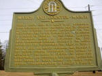
Site: Shoal Cr. Church GHM 031-34
NE of intersection of Flat Shoals Rd and Fayetteville Rd
Accuracy verified by Mapicurious.com - latitude=33.59068 longitude=-84.44765
|
|
|
|
Morrow, Georgia GHM 031-36
In front of Morrow City Hall, GA 54, Morrow
Accuracy verified by Mapicurious.com - latitude=33.58348 - longitude=-84.34017 |
|
|
|
|
|
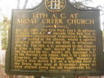
14th A.C. At Shoal Creek Church GHM 031-35
NE of intersection of Flat Shoals Rd and Fayetteville Rd
Accuracy verified by Mapicurious.com - latitude=33.59065 - longitude=-84.44760 |
|
|
|
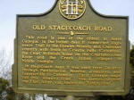
Old Stagecoach Road GHM 031-1
Stagecoach Rd and Panola Rd, Ellenwood
Accuracy verified by Mapicurious.com - latitude 33.61133 - longitude=-84.27040
|
|
|
|
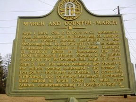
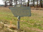
March and Counter-March GHM 031-12
US 23 at Fielder Rd about 1/2 mile north of I-675 junction
Accuracy verified by Mapicurious.com - latitude=33.57778 - longitude=-84.28727 |
|
|
|
|
|
Georgia Militia at Lovejoy's Station GHM 031-19
US 41 just below Talmadge Rd, Lovejoy
Accuracy verified by Mapicurious.com - latitude=33.43053 - longitude=-84.32055
Marker damaged click on link to read the text
|
|
|
|
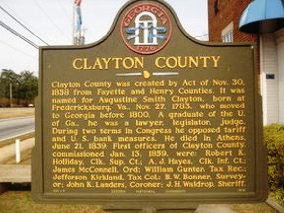
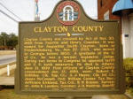
Clayton County GHM 031-7
Old Courthouse, Jonesboro
Accuracy verified by Mapicurious.com - latitude=33.52277 - longitude=-84.35395 |
|
|
|
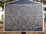
The Johnson-Blalock House
on west side of RR on Main St. between Spring and Smith Streets in Jonesboro
Accuracy verified by Mapicurious.com - latitude=33.52412 - longitude=-84.35448
|
|
|